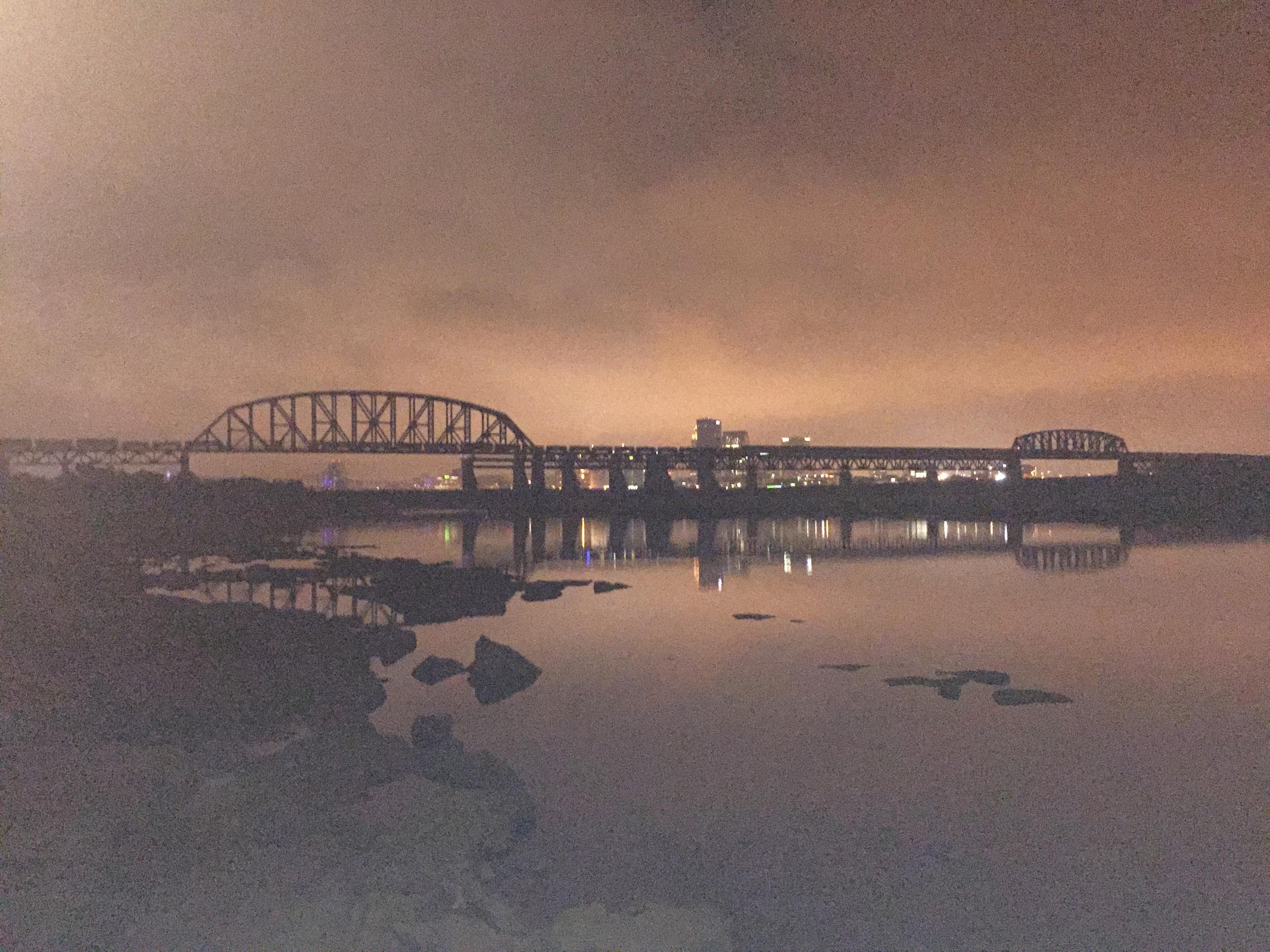
Stand at Falls of the Ohio State Park on the Indiana side, look down at the rock shelf under your feet when the river's low, and you're standing on the floor of a tropical sea. Not a metaphor — an actual sea, warm and shallow, that sat south of the equator about 390 million years ago, before Kentucky was Kentucky or Indiana was Indiana or there was a continent shaped anything like the one we've got now. The corals that lived in that sea died there, got buried, turned to limestone, and eventually — after roughly 390 million years of the planet doing what it does — ended up back at the surface, in a two-mile stretch of the Ohio River, as one of the best-exposed beds of Middle Devonian fossils anywhere on Earth. The National Park Service doesn't even try to call it the biggest. It just says nowhere else are rocks this old this easy to walk right up to.
That's the whole story, honestly. Everything else is just what happened after people showed up and had to deal with the rock.
Here's what I mean. The Ohio River runs 981 miles from Pittsburgh to the Mississippi, and for its entire length there is exactly one place a boat can't just float straight through. Two miles of rapids, a 26-foot drop, right here. Every other stretch of that river, at almost any water level, you point the bow downstream and go. At the Falls, you don't. High water, maybe you thread one of three narrow channels the local pilots learned from Native traders in the 1600s — the Indian Chute was so tight early boatmen widened it eighteen feet by hand, swinging sledgehammers at solid rock. Low water, you don't run it at all. You stop. You unload. You haul your cargo two miles overland. You reload it on the other side.
That single physical fact — stop here, or don't get through — is the reason there's a city here at all. It's the reason there are five of them, actually, because the same obstacle that built Louisville also built Portland and Shippingport on the Kentucky side and Clarksville, Jeffersonville, and New Albany on the Indiana side. A rock reef laid down by dying coral in a sea that doesn't exist anymore organized a thousand years of human settlement before anybody platted a street, and it's still organizing where you'd want to buy a house today. I'll get to that part. Let's start at the beginning.
The rock decided things before we did
Long before 1778, the Falls already had a say in how people lived here. Kentucky's own state archaeologists will tell you the popular version of this history — that the land was empty, an unclaimed hunting ground waiting for someone to found a city on it — is a myth, and not an old one either. It goes back to Kentucky's first historian, John Filson, who looked at the region's abundant Native archaeological sites and decided they must be old battlefields, evidence of a "dark and bloody ground" nobody actually lived on. They weren't battlefields. They were villages and camps, occupied and reoccupied in the same places for hundreds or thousands of years, going back more than 11,000 years total.
And here's the detail that gets me: the Falls split them into two different cultures. West of the rapids, the Mississippian culture — town-and-mound communities, up to 600 people, complex chiefdoms, starting around 900 A.D. East of the rapids, Fort Ancient culture — tribal villages of 25 to 500 people built around central plazas, developing about a century later and lasting 650 years. Two distinct ways of organizing a society, meeting at a boundary drawn by two miles of impassable water. Later, Shawnee, Cherokee, Delaware, Miami, and others used the region heavily for hunting and travel while keeping their main towns elsewhere — which got twisted, conveniently, into the claim that nobody was really "here." The rock was drawing lines on this map a thousand years before Kentucky was a word.
An eclipse, an island, and a lot of desertions
George Rogers Clark showed up on May 27, 1778, with something like 150 soldiers and a few dozen settler families, and set up camp on Corn Island — a 43-acre island that sat in the river just above the Falls. He wasn't planning to found a city. He was planning a secret military campaign against the British in the Illinois country, and he needed a staging area his men couldn't easily walk away from. An island works well for that.
Then, on June 24, when it was finally time to leave, Clark's men shot the rapids — and in his own words, "at the very moment of the sun being in a great eclipse, which caused various conjectures among the superstitious." That's not embellishment. There really was a total solar eclipse that day, its path running clear across the continent from Baja California to New England, and Clark's small army watched the sky go dark as they ran the Falls. Whatever his men thought that meant, they took Kaskaskia without firing a shot ten days later, on July 4th — the campaign succeeded, and the frontier west of the Appalachians stayed, barely, in American hands.
The desertions are the part nobody tells you, though, and I love it because it's the same geography doing two different jobs at once. Clark had kept his real mission secret from most of his men, and when a few finally got wind of where they were actually headed, one company simply waited for a night when the water was low enough, waded the same channel that made this spot a portage in the first place, and walked home. The Falls stopped boats. It didn't stop deserters.
Virginia chartered the town two years later, on May 1, 1780, naming it Louisville for King Louis XVI of France, whose alliance had just kept the Revolution alive. The following year, the state carved out 150,000 acres on the Indiana side as payment to Clark's soldiers — Clark's Grant — and set aside 1,000 of those acres for a town. Clarksville, chartered in 1783, is generally regarded as the first American town in what would become the Northwest Territory. Clark himself eventually retired to a cabin there, overlooking the Falls he'd once run under an eclipse, before moving across the river to his sister's home at Locust Grove, where he died in 1818.
The Falls' second act: starting an expedition
Twenty-five years after Clark ran the rapids, his younger brother William was waiting at the Falls for a friend he'd never actually met in person. Meriwether Lewis arrived on October 14, 1803, and the two men who'd go on to lead the most famous expedition in American history first stood face to face somewhere around here — the historical record is clear on the date, a little fuzzier on which side of the river. What's not fuzzy: seven of Clark's recruits were waiting for Lewis when he got here, and Lewis brought two more with him. History remembers them as the "Nine Young Men from Kentucky" — a name that stuck through every account that followed, even though, as one Lewis and Clark historian dryly notes, not all nine actually were from Kentucky. Branding got ahead of the facts even in 1803.
They pushed off on October 26, 1803, and headed west. If you want to argue the Lewis and Clark Expedition really started at the Falls of the Ohio rather than at some point further up the Missouri, I don't think you'd be wrong.
The Graveyard of the West, and the year everything turned
For a while, this place nearly killed the people who tried to build it. Stagnant ponds around the settlement bred mosquitoes nobody understood yet, and in 1822 a malaria outbreak sickened roughly a quarter of Louisville's population and killed at least 140 people. The city picked up a nickname it earned honestly: the Graveyard of the West. The fix, in 1823, was a lottery-funded drainage company that spent $60,000 filling ponds and digging channels, and by the end of the decade the standing water — and most of the disease with it — was gone.
That happened to finish right around 1830. Which is the same year, as it happens, that Louisville solved its other defining problem.
The canal Louisville built to keep its problem
For twenty years, Kentucky chartered one canal company after another to finally cut a channel around the Falls, and for twenty years, almost nothing got built. Four charters between 1804 and 1825, and no dirt moved until the federal government put money behind the fifth one. Read that timeline uncharitably and you'd say Louisville was dragging its feet. I think the truth is better than that, and it's backed by actual scholarship: Louisville wasn't just slow to solve the problem. Louisville was making a very good living off the problem, and it built a canal that was just good enough to keep making that living.
Construction finally started in 1826, and the Louisville and Portland Canal opened in December 1830 — a mile and nine-tenths long, with three locks stepping boats down the same 26 feet the river drops naturally. Here's the catch: the locks were only 182 feet long and about 50 feet wide, which was too small for the biggest steamboats on the river. Historians studying the canal's own record concluded Louisville was, in their words, "content to allow the situation to continue because they had just enough of a canal to increase the importance of their city." Big boats still had to break cargo at Louisville, canal or no canal. The city that solved the Falls problem also made sure it never fully went away.
Indiana, watching all this from the other bank, tried to build a rival canal of its own — an audacious plan to dam a creek and let the water carve its own channel, with none other than Aaron Burr sitting on the company's board before his conspiracy scandal sank the whole operation. When the dam failed around 1819, one Indiana historian later claimed "someone from the rival canal company in Louisville" sabotaged it. Nobody will ever prove that. It could just as easily have been muskrats. But two hundred years later, it's a pretty good encapsulation of how these two riverbanks have always eyed each other.
Once it opened, the canal's tolls tell the story of a boomtown: $12,750 collected in 1831, $145,424 by 1837 — an elevenfold jump in six years. And a footnote worth sitting with: Shippingport, the little town right below the Falls that had grown up around the old portage trade, got cut off into an island once the canal sliced across the peninsula. It never recovered. Floods in 1832 and 1937 emptied it out further, and in 1958 the federal government condemned what was left to widen the canal, evicting families whose roots there ran back more than a century. Louisville's growth had a cost, and Shippingport paid most of it.
New Albany's ninety people, and the fastest fall in Indiana history
While Louisville was managing its bottleneck, the town across the river was quietly winning. In the 1850 census, New Albany, Indiana — founded in 1813 by the Scribner brothers — was the largest city in the entire state of Indiana. Population 8,181. Indianapolis was second, at 8,091. Ninety people. That's the whole margin. Before the Civil War, more than half of all Hoosiers worth over $100,000 lived in New Albany, and its shipyards — the Howard family alone built more than a thousand vessels there over 107 years — made it one of the great inland boat-building centers in the country. A New Albany-built steamboat, the Robert E. Lee, won the most famous race in American river history in 1870, beating the Natchez from New Orleans to St. Louis by hours — though it's worth knowing the winning captain stripped his boat of cargo, refused paying passengers, and pre-staged fuel barges downriver so he'd never have to stop. Winning ugly is still winning.
Then it fell apart fast. The steamboat trade collapsed by 1870. New Albany's economy had been built on shipping goods south, and during the war both sides distrusted a city with such ambiguous loyalties. Its second-biggest industry, a plate glass works, packed up and left in 1893. By 1860, ten years after beating Indianapolis by ninety people, New Albany had 12,647 residents to Indianapolis's 18,611. The railroad capital had lapped the river town in a single decade and never looked back. New Albany reinvented itself — by 1920 it was the largest plywood and veneer producer in the world — but it never got back what the rivers had given it.
Louisville, meanwhile, chartered the Louisville and Nashville Railroad in 1850, opened the line to Nashville in 1859, and spent the Civil War profiting handsomely off Union haulage contracts paid in real currency instead of depreciating Confederate paper. Kentucky declared itself neutral in May 1861, a position that held for about four months before Confederate troops crossed the line first and the legislature threw its support to the Union. Louisville itself was never once attacked or captured through the whole war, even as roughly 80,000 Union troops passed through it. The line that gets repeated about Louisville "joining the Confederacy after the war was over" is one of those sayings everyone's heard and nobody can quite source — but there's a story just as good and fully documented: in 1869, a former Confederate governor sitting on the Kentucky bench ruled part of federal Reconstruction law didn't apply here, on the grounds that Kentucky had never actually left the Union in the first place. Technically correct. Extremely Kentucky.
Prohibition's accidental gift, and the bourbon industry's own honest math
Here's a piece of bourbon history that almost never makes it into the marketing copy: Prohibition should have wiped Louisville's whiskey business off the map. Instead, it concentrated it. The federal government authorized exactly ten licenses nationwide to keep producing whiskey for "medicinal" purposes during Prohibition. Only six companies bothered to apply — nobody else thought there was a real business in it. At least three or four of those six were Louisville operations, including Brown-Forman, founded in 1870 by George Garvin Brown, whose real innovation wasn't inventing bottled bourbon (bottles existed) but insisting on selling it only in sealed, labeled bottles, as a guarantee against the barrel-dipping fraud that was common at the time. Brown-Forman is the only one of the six original medicinal-license holders still standing today with its founding family still running it.
Stitzel-Weller opened on Derby Day 1935 in Shively, deliberately just outside the city limits to dodge Louisville's taxes while keeping access to the water. Congress got around to declaring bourbon officially American in 1964, a resolution that reads almost defensively: bourbon is "a distinctive product of the United States and is unlike other types of alcoholic beverages, whether foreign or domestic."
And since we're being honest: the number everybody quotes — that Kentucky makes 95% of the world's bourbon — is a guess. Not a lie, just a guess. The Kentucky Distillers' Association's own president has said publicly that the figure originated as his seat-of-the-pants estimate. Count Tennessee whiskey, which is bourbon in every meaningful way except the label, and the real number is closer to 75%. I'd rather tell you the true version, because the true version is still remarkable: as of January 2025, there are 17.1 million barrels of whiskey aging in Kentucky warehouses — more than three and a half barrels for every single person who lives in the state. Kentucky is the only place on Earth that taxes barrels just for sitting there aging, and that tax alone brought in $75 million last year, up 163% over five years. The whole industry now runs a $10.6 billion annual footprint through the state and employs almost 24,000 people. Whatever the real percentage of the world's bourbon is, it's made mostly right here, and it isn't close.
A bat that vents a bathroom, and a slugger who never got his
Louisville Slugger has a founding story it's told for over a century: in 1884, seventeen-year-old Bud Hillerich slipped out of his father's woodworking shop to watch a game, saw local star Pete Browning break his bat mid-slump, offered to carve him a new one overnight, and Browning went on a hitting streak the very next day. It's a great story. It's also, according to the baseball historians who've actually dug into it, almost certainly not true — no Louisville paper mentioned it at the time, Browning was a celebrity who publicly named and kept his favorite bats rather than tossing them, and the first version of the story in print didn't appear until 1914, thirty years after it supposedly happened, and told a different origin entirely. What's real: the Hillerich family trademarked "Louisville Slugger" in 1894, and in 1905 Honus Wagner became the first athlete in American history to endorse a piece of sporting equipment for pay. The company survived, the myth survived better, and today there's a 120-foot, 68,000-pound steel bat leaning against the museum downtown — an exact-scale replica of Babe Ruth's model, built by a local water-tower company. Its footing runs 40 feet underground, and it does double duty as the plumbing vent for the museum's basement bathrooms, which is genuinely the reason the city allowed a 120-foot structure downtown in the first place. I don't think you can make that up. Nobody did — it's just true.
The man who built the Derby and didn't live to see it matter
You already met William Clark's family once in this story — his brother founded the city, and Lewis found him waiting at the Falls in 1803. His grandson founded something else. Meriwether Lewis Clark Jr. spent over a year touring England and France studying Epsom and Longchamp, raised $32,000 to build a one-mile dirt track, and personally covered the grandstand costs out of pocket when the money ran short. The Kentucky Derby ran for the first time on May 17, 1875 — winner Aristides, jockey Oliver Lewis, one of thirteen Black jockeys out of fifteen riders in that first field. Clark ran the club for twenty years without ever taking a salary, paying its debts himself, until a legendary temper cost him his biggest owner in 1886 and sent the Derby into a two-decade decline. The track sold in 1894. Clark died by his own hand in 1899, never seeing what the race would become.
Even the Twin Spires — the single most recognizable image in American sports — started as an afterthought. A 24-year-old draftsman named Joseph Baldez added them to the 1895 grandstand simply because he felt the building "needed something to give it a striking appearance." They didn't become the sport's defining symbol until decades later.
What the Derby has become since is not in question. Derby Week wagering hit a record $487 million in 2026. The 152nd running, that same year, was won by trainer Cherie DeVaux — the first woman ever to train a Kentucky Derby winner. And the race that Clark built on borrowed money and personal debt has run every single year since 1875, moved twice off its calendar date (once for World War II, once for COVID) but never once cancelled. Longest continuously held annual sporting event in the country. Clark didn't live to see any of it. Founders rarely do.
The flood that drew the map we still live inside
On January 27, 1937, the Ohio River crested at Louisville at 57.15 feet — a full ten feet above the second-worst flood the city had ever recorded. Roughly 70% of the city went underwater. About 175,000 people, close to two-thirds of the population, were forced from their homes, and across the whole Ohio Valley the flood killed hundreds and left close to a million people homeless. Ninety percent of Jeffersonville, Indiana, was underwater too.
The story I want you to know is what happened at WHAS radio. When Louisville lost power, the station in Nashville — WSM, a direct competitor — handed over its own frequency and transmitter so WHAS could stay on the air, broadcasting rescue orders street corner by street corner over a single surviving phone line, pushing out 115,000 emergency bulletins by loudspeaker truck and airplane. One of the announcers on duty, Foster Brooks, later became a famous comedian. That's the kind of detail that gets lost if you only remember the flood as a statistic.
Here's the part that actually matters if you're thinking about real estate in this city today: the response to 1937 wasn't just recovery. It was a permanent redrawing of the map. Construction on Louisville's floodwall system started in 1948 and wasn't fully finished until the late 1980s — 29 miles of concrete wall and earthen levee, sixteen pumping stations, 148 control gates, protecting about 110 square miles of the city. Everything inside that line got to keep developing. Two neighborhoods that ended up outside it — Shippingport, which the canal had already half-killed, and a riverside area known as The Point — never came back at all. The flood didn't just damage buildings. It permanently decided which parts of this city were buildable and which weren't, and that decision is still visible on a map today, ninety years later. You can see how that history plays out in current conditions in our monthly Louisville Housing Market Report.
The park system that pays for itself
In 1891, Louisville hired Frederick Law Olmsted — the same man behind Central Park — to design a system of parks and parkways for the city, and what got built is, by Olmsted's own firm's account, one of only four complete park systems he finished in his career, alongside Buffalo, Boston's Emerald Necklace, and Rochester. Eighteen parks and six parkways, anchored by three flagships — Cherokee, Iroquois, and Shawnee — tied together by nearly fifteen miles of tree-lined parkway.
This isn't just a nice historical footnote. A 2018 study by the firm PlaceEconomics put an actual number on what those parks are worth: homes fronting an Olmsted park carry a 5.5% price premium per square foot over comparable homes that don't, adding up to $94.7 million in extra property value citywide, generating close to $900,000 a year in additional property tax revenue — enough, by the study's own framing, to cover roughly seventeen teachers' salaries. More than half the city's "creative class" jobs sit within a half-mile of an Olmsted park. A design decision made in 1891 is still showing up as a measurable line item in property values 135 years later. If you're trying to understand why certain parts of this city hold their value the way they do, that's not folklore. That's a documented, quantified fact about how this market works.
Fort Knox, a stolen bicycle, and a few myths that don't hold up
Thirty miles southwest of downtown sits the U.S. Bullion Depository, holding roughly 147.3 million ounces of gold behind walls of granite and reinforced concrete — a building so secure it held the actual Declaration of Independence and Constitution during World War II, just in case.
And twelve-year-old Cassius Clay, walking around Louisville in 1954, had his brand-new red Schwinn bicycle stolen while he was inside an event downtown eating free food. Furious, he found an off-duty cop named Joe Martin who ran a boxing program out of the basement of a local gym and told him he was going to whip whoever took it. Martin told him he'd better learn how to fight first. Six years later, Clay — soon to be Muhammad Ali — won Olympic gold in Rome at eighteen years old. (The story that he threw that medal into the Ohio River after being refused service at a whites-only restaurant is disputed by people who knew him — his biographer's best guess is he simply lost it about a year later, which somehow feels even more human.) Ali came home to Cave Hill Cemetery when he died in 2016, buried not far from Colonel Sanders, and the airport code stayed SDF even after Louisville renamed the terminal for him in 2019.
I'll be straight with you about a few other Louisville legends while I'm at it, because I'd rather you hear the honest version from me than the polished one from a tourist brochure: the Hot Brown, invented at the Brown Hotel in 1926 to feed exhausted dinner-dance guests, is exactly as real as advertised. Derby-Pie, created in 1954 at a Prospect restaurant by a family who liked the treat so much they couldn't agree on what to call it and drew the name out of a hat, is also real, and the recipe today is known to a small handful of people and has generated something like 25 lawsuits defending the trademark. The Old Fashioned supposedly invented at the Pendennis Club — that one's genuinely disputed by cocktail historians, and I think it's more fun to just say so than to keep repeating a claim nobody can actually back up. Same with the cheeseburger at Kaelin's — a great Louisville story, but Pasadena and Denver both have earlier, better-documented claims. A city this old collects a few tall tales along the way. Doesn't make the true stuff any less remarkable.
What was happening on the Indiana side while nobody was looking
While Louisville built parks and races and a whiskey monopoly, Southern Indiana was quietly becoming something else entirely — an industrial back lot for a war nobody in 1940 knew was coming. The federal government broke ground that September on what became the Indiana Army Ammunition Plant in Charlestown, eventually 10,655 acres employing over 27,500 people by May 1941. During World War II, this single plant's smokeless powder output exceeded the combined total production of every other smokeless powder plant in the entire country during all of World War I. Today, 3,000 of those acres are the River Ridge Commerce Center, and 4,500 more became a state park.
A few miles away in Clarksville, the Colgate soap plant lit a 40-foot clock for the first time on November 17, 1924 — a clock that, for decades, was billed as the second-largest in the world. What almost nobody remembers is the building underneath it: it had originally been a state prison, and when Colgate bought the site in 1923 after a fire forced the prison's relocation, the labor of converting a penitentiary into a soap factory was done, in part, by incarcerated men.
The two big interstate bridges that connect Louisville to New Albany and Jeffersonville both have stranger histories than you'd guess. The Sherman Minton Bridge, opened in 1961 and renamed for a New Albany native who sat on the U.S. Supreme Court, was abruptly shut down for five months in 2011 after inspectors found cracks in a load-bearing beam — a genuine natural experiment in just how much this region depends on the river crossings staying open. The John F. Kennedy Memorial Bridge opened in December 1963, and Governor Bert Combs announced the renaming just four days after the president's assassination — the bridge was renamed before it had even opened to traffic.
And Southern Indiana's tourism arm used to brand itself, for decades, as "the Sunny Side of Louisville." In 2016, they killed the slogan on purpose, after their own research found that defining the region entirely in relation to the city across the river was actually hurting it. They rebranded as "SoIN" instead. It's a small, honest moment in a much bigger story: Southern Indiana has spent two and a half centuries figuring out how much of its identity to build in Louisville's shadow and how much to build on its own, and that question is still very much alive today — maybe more alive than it's ever been.
The rock's third act: why the mail flies over your house
Here's where the geology comes back around, and I think it's the best part of the whole story. The reason a town grew up at this exact bend of the Ohio River in 1778 is that this was the one place on 981 miles of river where you had no choice but to stop. Two and a half centuries later, this metro area sits at the center of a very different kind of network, and once again, almost nobody chooses to stop here on their way through — except now it's on purpose, and it's air freight instead of flatboats.
UPS built Worldport here, a 5.2-million-square-foot sorting facility — call it ninety football fields — that handles somewhere north of 400,000 packages an hour and around 360 flights a day. It grew from a facility sorting about 2,000 packages a day in the early 1980s to roughly two million a day now. In 2025, Louisville's airport moved more cargo than every airport in North America except one — beating Memphis, home turf to UPS's biggest rival FedEx, by more than 427,000 metric tonnes. Only Hong Kong, Shanghai, and Anchorage handled more freight anywhere on Earth. Greater Louisville Inc. puts the underlying logistics case plainly: this region sits within a day's truck drive of roughly two-thirds of the entire U.S. population. I won't pretend anybody's written the sentence connecting the Falls of the Ohio directly to Worldport — that's my read, not a historian's — but I don't think it's a coincidence that the same stretch of America that forced river traffic to stop for 150 years turned out to be exactly where you'd want to build the country's biggest package-sorting hub two centuries later. Being in the middle of everything was the whole advantage the first time. It still is.
I'd be doing you a disservice if I only told you the good part, though, so here's the honest counterweight: 2025 and 2026 were genuinely hard years for UPS here. A cargo plane went down on takeoff from Worldport in November 2025, killing fifteen people, and the company has been cutting tens of thousands of jobs nationally as shipping volumes shift. This region's largest employer is going through real change right now, and I'd rather tell you that straight than pretend everything's up and to the right.
Because plenty of other things genuinely are. GE Appliances — 23,000 employees here at its 1970s peak, down to about 8,100 today — just committed a billion dollars, announced September 2nd of this year, to bring dryer manufacturing back to Louisville from Mexico, securing 4,700 production jobs. Ford is putting roughly two billion dollars into the Louisville Assembly Plant to build its first affordable electric pickup, launching in 2027. Humana, founded here in 1961 as a nursing home company before growing into a Fortune 35 health insurer, is still headquartered downtown. And across the river, a former World War II ammunition plant — the same one that out-produced all of WWI's gunpowder combined — is now the River Ridge Commerce Center, generating $3.6 billion a year for Southern Indiana's economy and hosting Amazon, Meta, and Medline among more than seventy employers.
That last one deserves its own sentence, because it's the cleanest illustration I know of how this region's two halves are diverging right now. In the summer of 2025, Kentucky's Oldham County killed a proposed $6 billion data center after community opposition organized against it. That same year, Meta broke ground on an $800 million data center in Jeffersonville, Indiana — eight miles away, same metro, opposite decision. It's not an isolated data point. Clark County, Indiana has grown roughly 7.5% since 2020. Jefferson County, Kentucky grew about a tenth of a percent last year — just over a thousand people, in a county of more than 770,000. Cross the river to live and work, and depending on the county, your effective state-and-local income tax rate drops close to a full percentage point. I'm a Kentucky Realtor, and I'll tell you plainly: the growth in this metro has been moving north across the bridges, and any honest conversation about where to buy right now has to reckon with that.
None of which changes the fundamental math that's kept this region a genuinely good place to invest for two hundred years running. The median home here still runs roughly 30% below the national median. Average rent runs almost 40% below the national average. This is, and has basically always been, one of the more affordable places in America to own real estate relative to what that real estate is actually worth — which is exactly the kind of gap this region's whole history has been built on exploiting, going all the way back to a canal company that made money off a bottleneck instead of just complaining about it.
What all of this is actually telling you
I've spent a lot of words on rock and reefs and rivers, so let me tell you plainly what I think it adds up to. This is a place that has never once been handed anything easy. Boats had to stop here whether they wanted to or not. Malaria nearly emptied the city before it had finished being founded. A flood drew a permanent line through the map that's still visible on every plat book in the county. And every single time, for two hundred and fifty years, the people here turned the obstacle into the advantage — a portage into a canal monopoly, a scarcity into a bourbon dynasty, a bottleneck at the Falls into a bottleneck for the entire eastern half of the country's overnight mail.
I think that's actually the most useful thing you can know about buying or investing here. This isn't a market that runs on hype. It runs on geography and stubbornness, and both of those things are still fully intact. The rock is still exactly where it was 390 million years ago. The people who live around it are still doing what they've always done with it.
If you're thinking about calling any part of this — Louisville, New Albany, Jeffersonville, Clarksville, any of it — home, or if you're looking at it the way I look at most things, as a place to put money to work, I'd genuinely love to talk it through with you. That's the whole job at Winner Realty. We're not the biggest brokerage in town, and we don't need to be — we just try to actually know this place, all of its history and all of its current numbers, better than the next agent does.
Frequently Asked Questions
Why is Louisville called Louisville?
Virginia's General Assembly chartered the town on May 1, 1780, naming it for King Louis XVI of France, whose support helped keep the American Revolution alive.
Why does Louisville exist where it does?
The Falls of the Ohio — a two-mile stretch of rapids and the only place on the entire 981-mile Ohio River where boats couldn't pass straight through — forced river traffic to stop, unload, and portage. That stop became a city.
What caused the 1937 flood, and how bad was it?
The Ohio River crested at 57.15 feet on January 27, 1937, about 70% of Louisville went underwater, and roughly 175,000 residents were displaced. The city's floodwall system, built between 1948 and the late 1980s, still defines which parts of Louisville are developable today.
Is Southern Indiana growing faster than Louisville?
Recent Census data shows Clark County, Indiana growing significantly faster than Jefferson County, Kentucky, driven partly by lower cross-river tax rates and large employers like Meta's Jeffersonville data center.
How big is Kentucky's bourbon industry today?
As of January 2025, more than 17.1 million barrels of whiskey were aging in Kentucky warehouses — over three and a half barrels for every person in the state — supporting a $10.6 billion annual industry.
Why is Louisville a hub for UPS?
UPS Worldport, a 5.2-million-square-foot sorting facility, handles roughly 400,000+ packages an hour. In 2025 Louisville's airport moved more air cargo than every airport in North America except one, thanks in part to its central location within a day's drive of about two-thirds of the U.S. population.
Talk soon,
Rob Bergeron
Owner–Realtor, Winner Realty
Sources for every figure in this piece — flood crest data (Filson Historical Society, National Weather Service), Olmsted park valuations (PlaceEconomics, 2018), bourbon industry statistics (Kentucky Distillers' Association), UPS cargo rankings (Airports Council International), and population and tax data (U.S. Census Bureau, Indiana and Kentucky Departments of Revenue) — are available on request.